
-

-
Government Services
Construction of Geographical Information Benchmark in Urban Area We utilize the algorithm for building and road in combination with long time series, large scale and high frequency remote sensing i...
— 2022-10-31
-
-
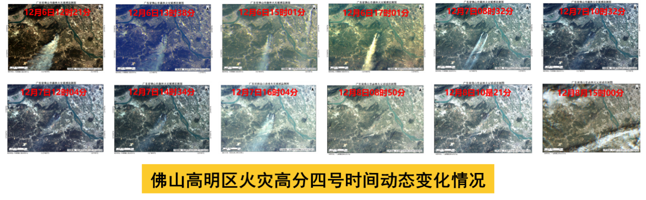
Fire Monitoring
We make the task plan of domestic satellite combined imaging and employ transit satellites to conduct consistent observation of the fire area, real-time monitoring of dynamic development of fire...
— 2022-07-28
-
-
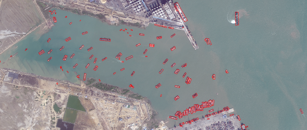
Maritime Security
We can utilize abundant optical and radar satellite images, real-time AIS information and advanced AI algorithm to rapidly and timely provide all types of critical information on vessels, identi...
— 2022-07-28
-

-
Energy facility inspection
Energy Facilities Inspection We can utilize our satellite constellation and unique analysis capabilities to inspect energy facilities such as photovoltaic panel, windmill and oil tank, so as to...
— 2022-07-28
-
-
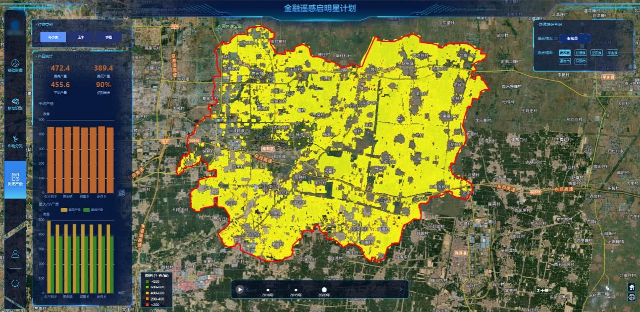
Agriculture
We construct full-process application scenario of digital village including land resources monitoring, agricultural census, crop monitoring as well as agricultural credit and other products, and ...
— 2022-07-28
